Hobart International Airport (HBA)
City Orientation and Maps
(Hobart, Tasmania (TAS), Australia)
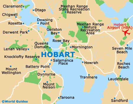
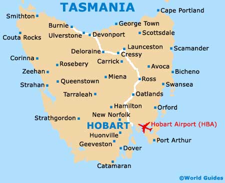
The city of Hobart is located on the south-eastern coast of the island of Tasmania, to the south of mainland Australia. Many towns and locations are situated close to Hobart, including Dynnyme, Tolmans Hill and Mount Nelson to the south-west, Mount Stuart, Glenorchy and New Norfolk to the north-west, Glebe to the north, and both Mornington and Lauderdale to the far east. To the south of central Hobart you will find Kingston and the scenic Lower Sandy Bay. Hobart International Airport (HBA) is situated within easy reach, to the east of the city centre.
The centre of Hobart is fairly small and compact, being particularly simple to navigate. Streets in central Hobart are laid out in an organised gridwork and are centred around the Elizabeth Street Mall, where you will find plenty of shops, stretching further west.
Hobart International Airport (HBA) Maps: Important City Districts
One of the most noteworthy parts of the city, Salamanca Place is known for its historic warehouses, which feature Georgian-style facades and appealing architecture, located along the waterfront on the southern side of Hobart, close to Battery Point. Other attractions further south include the University of Hobart, Sandy Beach and the Wrest Point Casino complex.
Situated to the north of Hobart city centre you will find a major recreation area known locally as the Domain. Home to the Botanical Gardens, this area is dominated by the Derwest River and the Tasman Bridge, an eye-catching structure forming part of the Tasman Highway and ultimately leading to Hobart Airport, Midway Point and Sorell.
Australia Map

Tasmania Map
Hobart Map